 Life is made of memories, and some memories recall exceptional moments. Years ago, I said I would never attend AirVenture until I could fly my own homebuilt to Oshkosh. In 2013 I flew my Cygnet to Oshkosh, and now I return annually and chair the Homebuilt Camping hosts. Last year, of course, was an exception due to COVID-19, but I was still able have a flying adventure in 2020 visiting the Utah backcountry.
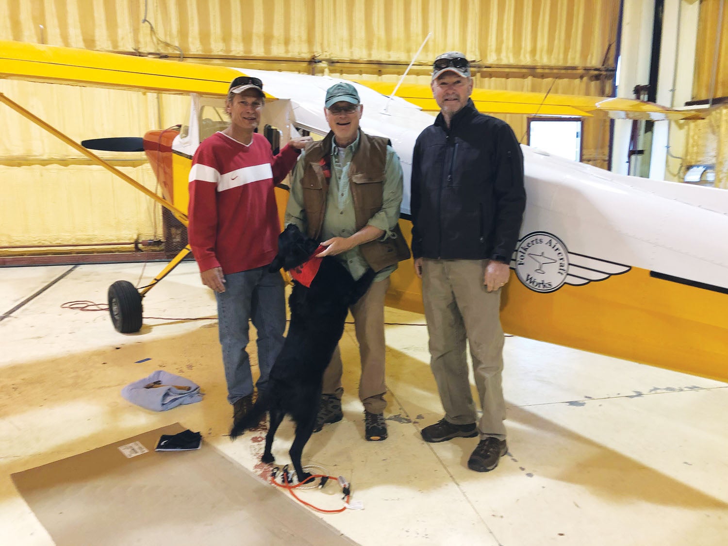
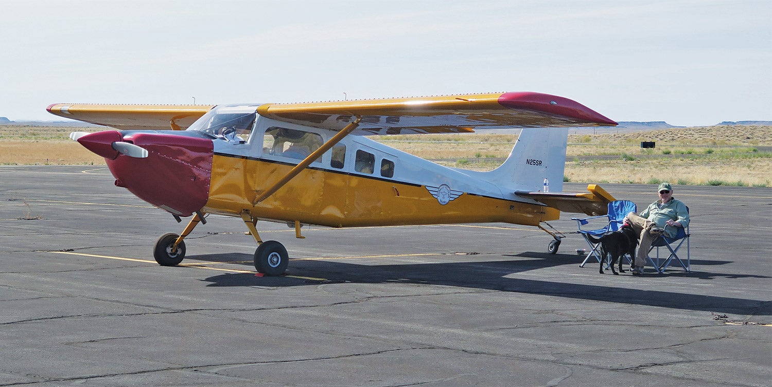
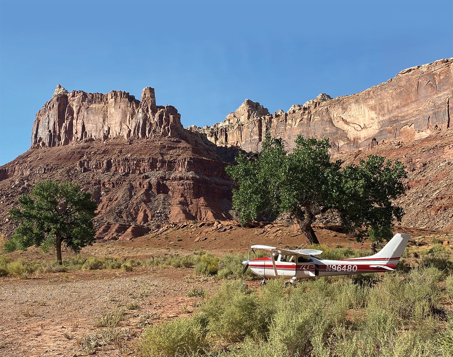
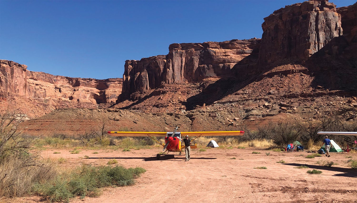
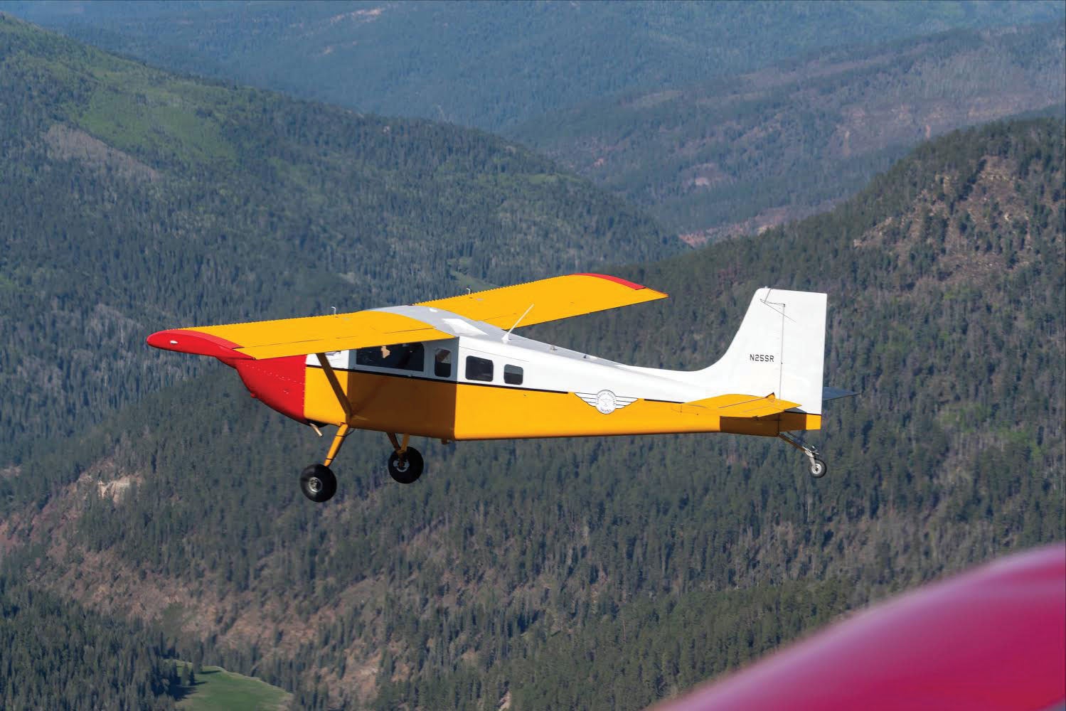
In 2018 I completed my Murphy Aircraft Super Rebel, N25SR, and also moved to Pagosa Springs, Colorado. Over the next two years, my wife and I built a home, doing most of the work ourselves. During that time, several friends forwarded pictures and videos of them flying their Super Cubs into the Utah backcountry. The bait was set and I took the hook. I spent hours researching the strips I believed would be best suited for a first-time backcountry pilot. Then Gregg Fitts, a hangar mate and RV-8 builder, committed to tagging along in his Cessna 182 minus wheel pants. The itinerary included Mineral Canyon (UT75), Cedar Mountain, and Mexican Mountain.
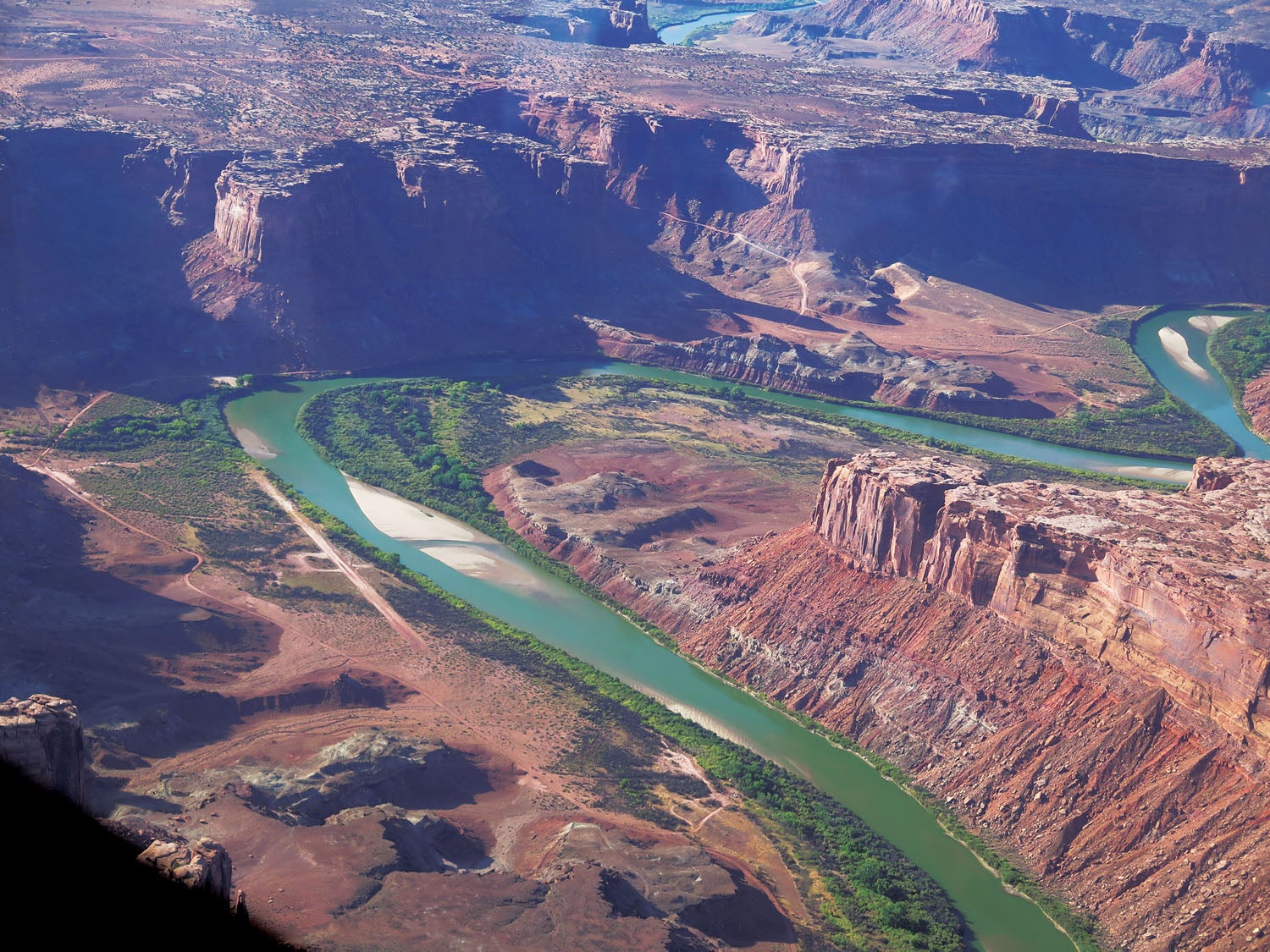
Mineral Canyon, also known as Mineral Bottom, is roughly 25 miles west of Moab, Utah, on the Green River. It was built to support a small uranium mine in the early ’50s. After the mine closed, the airstrip fell into disrepair. Today the land is administered by the Bureau of Land Management (BLM). In the fall of 1998, BLM issued a “right of way” permit for a company out of Canyonlands Regional Airport (KCNY) to use the strip commercially in support of rafting excursions and for public non-commercial use. The strip is at 3900 feet elevation and is approximately 2000 feet long, but the last several hundred feet are not always usable.
Cedar Mountain airstrip is another BLM-owned airstrip, located about 25 miles northwest of Green River, Utah. It sits on top of a mesa at 7550 feet elevation and is approximately 2000 feet long, with a noticeable upslope to the south. The strip supports a microwave tower and a few other towers located on top of the ridge. The southern edge of the strip is on a steep 1500-foot drop-off and offers fantastic views for over 100 miles.
Mexican Mountain airstrip is located approximately 10 miles northwest of Green River. In the early ’50s, Amoco Oil built the airstrip to drop an exploratory well in the area. With no success, they capped the well and moved on, leaving the airstrip behind. Later the area was designated a wilderness study area, but since the airstrip was built previous to the designation, it was open for use to the general public. The strip lies at an elevation of 4461 feet along the banks of the San Rafael River. It is perhaps the most scenic, but also one of the most challenging, of all the longer strips in the Utah backcountry. It provides access to hike the Black Boxes, Spring Canyon and Mexican Mountain. There is a small collection of petroglyphs within a 10–15 minute walk from the camping area.
at Green River Airport.
High Winds and Turbulence
After months of planning, a friend, Mike Buchner, my dog Cinder and I launched on a brisk late September Monday morning. A cold front had passed through the area the day prior, and the winds were forecast to be 15 mph at a 90° angle over Mineral Canyon. I was concerned about this and contacted the chief pilot at Redtail Air in Moab. He told me as long as we got in early, it would likely be a bit turbulent but doable. Unfortunately, we would have to approach from the south, which is the more challenging of the two approaches. Arriving overhead, we experienced quite a bit of turbulent air—so we flew over the area and planned our approach. We entered from the west in a side canyon, dropping down into the main Green River canyon. Due to the many side canyons and the wind overhead, we experienced large control deflections and a very uncomfortable ride. Despite that, we made the 90° left turn on the extremely short final, perfectly lined up while being bounced around. Unfortunately, the extreme wind gusts kept the Super Rebel airborne too long and a third of the way down the runway, I decided to go around and climb out of the canyon. Once we were above the rim, I told Mike I wasn’t comfortable trying it again and we headed for the airport at Green River, Utah, about 50 miles to the north.
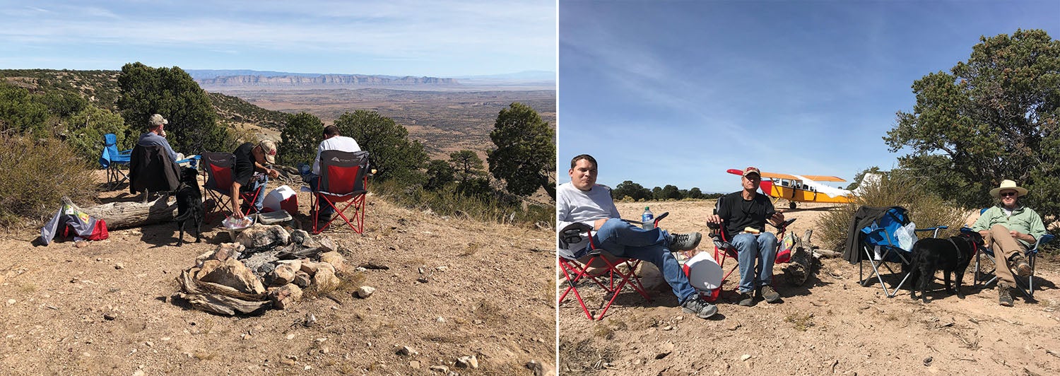
Later on during the trip, I met the chief pilot at KCNY while refueling, and he said he had been concerned about us as the winds were higher than forecast. So—Mike and I ate lunch while we waited on Number Two, Gregg and his son Ryan, to meet us in their Cessna 182 at Green River. After a check of the weather, it appeared the winds were less to the north and we decided to head up to Cedar Mountain.
Cedar Mountain and Mexican Mountain
After takeoff from Green River, we flew up the incredible San Rafael swell, past Mexican Mountain, and were overhead Cedar Mountain within 30 minutes. Gregg landed first to the south, and after he cleared the runway we approached from the north. The amount of upslope surprised me, so I went around and came in at a lower angle. Still, the upslope surprised me.

Note to self: Normal flare, full-stall landings don’t work on an upslope! We bounced but were down safe and taxied up to the parking area near the edge of the cliff. It was a perfect spot to break out the chairs and have a bit of lunch. Despite some lingering smoke in the area from the West Coast fires, we could see as far as the La Sal Mountains, approximately 75 miles away.
After lunch we hiked around the airfield and discovered how remote it actually is. There is a forest service road into the area, but it would be more than a 50-mile trip to visit. Perhaps during hunting season you might have some visiting hunters camped nearby. We waited until almost 4 p.m. for the winds to settle down and then took off for Mexican Mountain.
Within 30 minutes we were circling around the mountain and overlooking the airstrip. The strip was originally about 2000 feet long, but today probably only 1500 feet is usable, with the remaining few hundred feet acceptable for rollout or a little extra on takeoff roll. The strip is generally 40 feet wide, with some large cottonwoods not far off the edge.
The general recommendation is to land to the west. Wind permitting, I agree. You can easily fly low over the streambed, making a gentle left turn for the last two miles and lining up for a spot touchdown. The strip is relatively hard packed with a few small pebbles, but it does have some soft areas on the eastern edge. After touchdown, we hit some soft material with the left main, and it caused a few seconds of intense skill to avoid a large looming cottonwood off to the left. I told Mike later, my years flying helicopters in the Air Force taught me to not panic but simply get myself out of the predicament I got myself into.
Flintstone Engineering

Shortly after, I learned an important lesson. Gregg had blown a tube in his right main on landing. He had changed the tire a week earlier but not the tube—the actual problem turned out to be the valve stem. With few resources available, the next few hours prior to dusk were interesting, including some “Flintstone engineering.” First, Ryan pumped up the tire with his bicycle pump. Mike found a few large rocks, and we placed them under the hardpoint on the Cessna’s gear leg. Gregg let out the remaining air in the tire, and it slowly lowered onto the rocks. Then we used the WW-II trenching tool I had in the airplane to dig a hole under the tire. Gregg had a small half-inch socket, but no extension. It barely fit within the rim to loosen the three pass-through bolts on the split rim. My Leatherman tool provided the wrench for holding the nut firm on the other side. The whole operation took about three hours, and now it was dark. But, the Cessna was now operational. Consequently, we didn’t have time to visit the petroglyphs but will plan on that for our next trip.
Back To Mineral Canyon
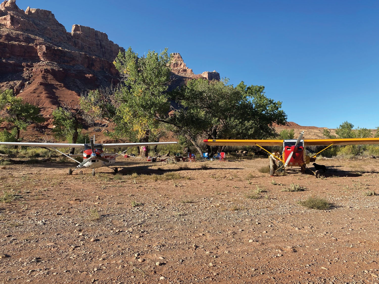
The following morning, we launched for Mineral Canyon. I was a bit concerned about the length of the strip at Mexican Mountain, so I added power prior to releasing the brakes and then, after raising the tail, kept it on the ground as long as possible for more airspeed than normal. Neither of us had any problems and, happily, we had a smooth 40-minute flight south toward Mineral Canyon. I entered below the rim first, approximately four miles upstream from a side canyon. Surprisingly, it takes a while to lower down safely into the 900-foot deep and winding canyon at slower airspeeds. I flew the curved walls of the canyon at 85 mph until I slowed for a 75-mph final, one mile out with full flaps.
My mentors had encouraged me to clear a small mesa on final at no more than 20 feet in order to make the first available landing spot at the end of the strip. We probably cleared the final edge at 10 feet and were lined up perfectly for a no-wind landing—which turned out to be the best one on the trip. I was stopped halfway down and pulled into a parking spot. On turning around, I saw Gregg zoom by on the ground. He lands 10 mph faster than I and was a bit higher coming over the mesa. Although perfectly acceptable, his rollout used some of the lesser-packed runway where there were also some varmint holes—be careful with nosewheels on the south end.
Unpacked and tents set up, we walked a mile downstream to a BLM boat ramp used by outfitters for trips ending there from Green River State Park and also for trips from the ramp down to the confluence of the Colorado River.
Need to know: There are excellent Forest Service-type bathrooms at the boat ramp. Surprisingly, we saw a couple launching for a 40-mile trip downstream on paddleboards, with a canoe behind them carrying their supplies.
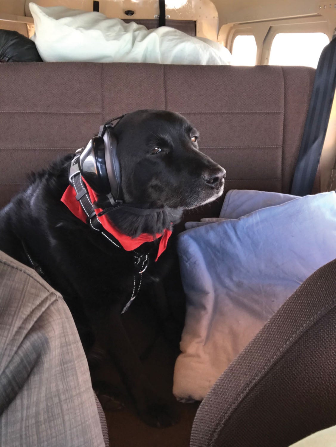
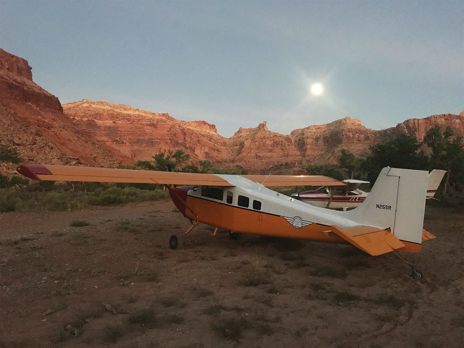
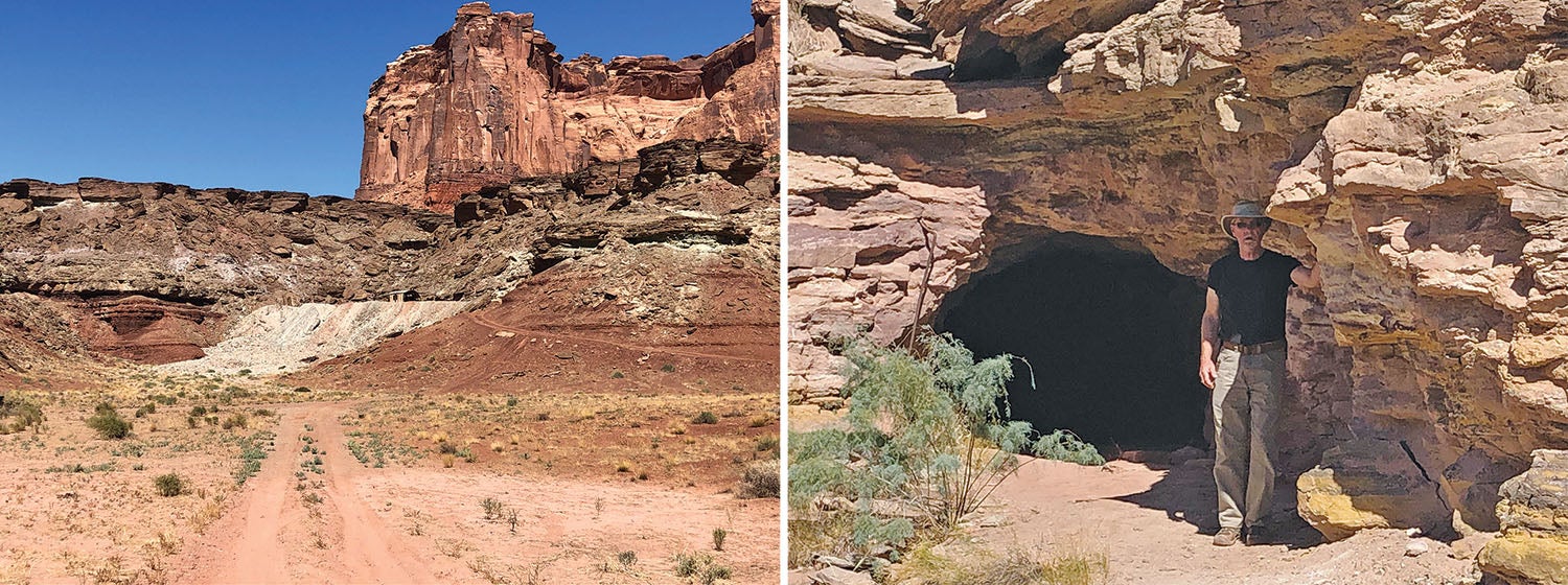
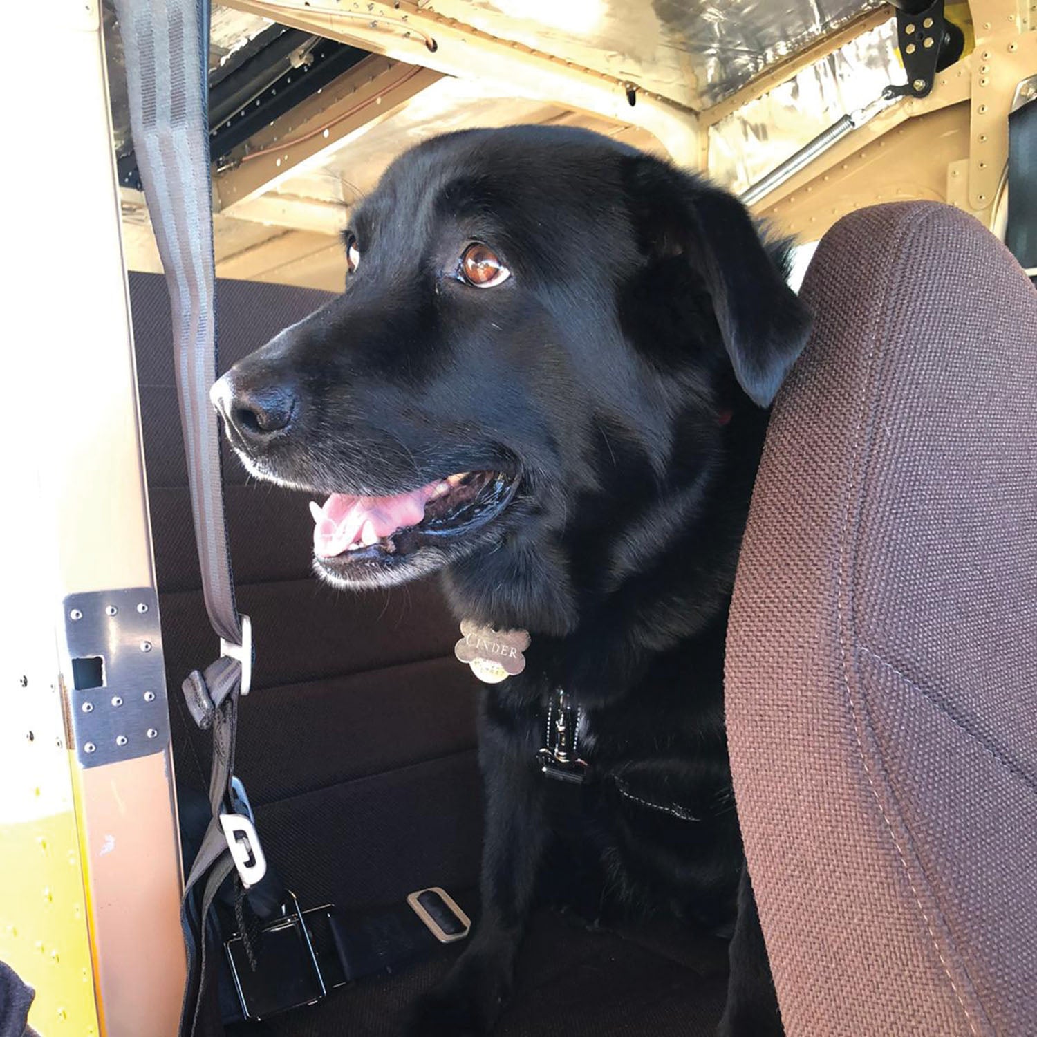
While we were gleaning good information from the ranger monitoring the launches, Cinder enjoyed a wonderful swim in the cool waters. Later, Mike, Cinder and I walked upstream and climbed up to the abandoned uranium mine. There we found two open horizontal mine shafts leading into the mountain. Being the old and not-so-bold pilots we were, the thoughts of “lions and tigers and bears” filled our minds with common sense, and we left the exploring to others. That night we had another full moon and found the canyon filled with light.
The next morning we quickly packed up as the temperature was rising noticeably. By takeoff a little after 9 a.m., it was already 72° F. We flew the 15 miles to KCNY, refueled and then headed back to Pagosa Springs. Although we encountered a bit of convective activity over the irrigated fields around Cortez, Colorado, it was a relatively smooth flight and we landed at home, tired but thrilled with what could be a true bucket list adventure fulfilled.
Know Before You Go
Since this was my first backcountry trip, I quickly learned a few things. First, prior planning makes for perfect performance. I spent many hours watching approaches and landings into each strip and that was truly beneficial. I also spoke with others who had visited each site and their advice was well heeded.
As I mentioned, we had some excitement changing the tube in Gregg’s right main tire. Consequently, upon return to Pagosa Springs, I went over the failure points on my aircraft and made sure I had the exact tools necessary to make repairs as required. I also included a few spare parts, such as a spare tube and other items that might be likely to fail in the field.
Don’t forget to do an actual weight and balance. We met the day prior to the trip and weighed all our baggage, with the exception of the final weight on the ice chest. As it turned out, the Super Rebel was 200 pounds under the 3000-pound gross takeoff weight and two inches forward of the wide-range CG. That said, I believe we were actually near or slightly aft. On takeoff from Pagosa it took much longer than normal to raise the tail, and then at normal takeoff speed it wanted to sit back down. At our first stop we moved as much weight forward as possible, which made a significant difference.
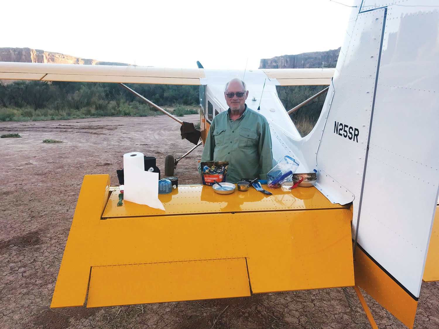
Keep it light. I weigh 220 fully dressed, Mike was 200 and Cinder had the back seat at 70 pounds. We had 150 pounds of cargo. The full-size cooler was just aft of the back seat, with 16 bottles of frozen water, a bag of ice, two six packs of beer and a few minor other things. Next time, I’ll skip the beer and take a box of wine, which I can slide under the back seat. We carried the rest of the water—16 bottles—behind the copilot seat on the floor. In addition, we had two small pack tents, two aluminum-framed chairs, Therm-a-Rest sleeping pads, sleeping bags, a few clothing items, a Jetboil stove plus dehydrated food. Gregg had more normal camping equipment, such as a Coleman stove, skillet, eggs, meat, juices and fruit.
Next time, I plan to downsize the cooler to the minimum necessary: a bit of summer sausage, cheese and jelly. We won’t need as much frozen water and can move the bottles farther forward in the aircraft. The Mountain Home dehydrated food is actually pretty good if you follow the instructions. Breakfast Skillet in the morning, peanut butter and jelly at lunch, sausage and cheese at happy hour, and then chili mac, lasagna, or stroganoff for dinner. The Super Rebel has a huge baggage area aft of the wing—just don’t plan on filling it up with heavy items. The Murphy Moose carries more weight up front with the M-14P radial and generally has a CG that is farther forward than the Super Rebel.
Plan on flying into these strips during the spring or fall, and check sources of local knowledge as to their current condition. The strips must be firm with no recent precipitation, and remember—soft strips also increase takeoff distance. In addition, the temperatures around Moab are quite high during most of the summer. When we took off from Cedar Mountain, the density altitude was around 10,000 feet. You will need to know how your aircraft performs under those conditions.
The Super Rebel is a taildragger with 6.00×8.00 tires. Perhaps with the exception of Cedar Mountain, I would be concerned attempting these strips with small tires. There are too many unknowns, holes, rocks and soft surfaces that could end in a bad day. Next year I plan to upgrade to 6.00×8.50 tires—a nice compromise between performance and increased off-field capability.
Finally, everyone who flies into these strips owes a great deal of gratitude to those who fought to preserve them for our use today and continually work to keep them open. That includes many passionate individuals and organizations, such as the Recreational Aviation Foundation and the Utah Backcountry Pilots organization. I encourage you to support them financially if possible and also help with volunteer work to maintain these strips. Plan carefully, fly safely and, above all, enjoy the unexplainable beauty.
Photos: Jerry Folkerts.


Great write up Jer. Hope you fly her to OSH again. SNF was very busy this year and many folks are headed to Oshkosh early, including me.
Blue skies and Tailwinds
Jerry Fischer
RV7 builder, Miss Sandy N364SJ
RV1 owner/caretaker The Mockingbird N5183
Great article Jerry. Inspires me to head that diection in the Bull Moose.
Ray
Gentlemen,
All I say is “wow”, “beautiful”, and “thank you” for this story and photos. Oh, and “I’m so jealous” 🙂
As a once-upon-a-time backpacker, I would’ve advised on the wine v. beer idea straightaway. If you really want to go pro, think a nice Islay scotch – goes great with a campfire.
Also, I assume you didn’t describe your entire kitchen but in the interest of completeness I’d add only one thing – a water filter. That way you’d be fine if you got stuck somewhere longer than expected.
R
Excellent read Jerry, thanks for sharing your experiences. Hopefully we’ll meet up again in Oshkosh for the MAM gathering.
Cheers,
Jeff & Penny
West Coast Kit Planes Ltd.
Great to meet you this year at KOSH-HBC! Next year I will try to remember to bring a copy of the June KITPLANES for you to sign! Great article, the plane, the dog, camping with friends and the Utah backcountry!
Bob
EAA Chapters 1519 (964), 753, 58 & 23
Comments are closed.