When I was mired in some of the more frustrating and tedious parts of building a kit aircraft, I would often reenergize myself by dreaming about adventures that I knew lay ahead—if only I could get the @#$& project done. I particularly enjoyed and drew inspiration from travelogue-type yarns of interesting places. I consumed them with relish and still do.
With that as a backstory, I offer this adventure through Arizona and Utah’s “color country” region. Even though I am blessed to have this area in my backyard, I can aver with all sincerity that anyone would be hard-pressed to find more spectacular scenery anywhere else in the world. OMG moments right after another for days.
I’ve done versions of this trip several times over the years with small groups. We try to put together an efficient mix of air and land adventures that make for full but not exhausting days—with plenty of extra time and alternatives if weather or machinery demand extra time. I highly recommend groups of no more than three or four aircraft. More than that can complicate logistics and increase the chance of someone having a trip-interrupting event.
Day One, Step One
For this trip, we were three couples and one pair of pilot buddies in four aircraft, all of which were 10s—two of the RV variety and two of the C2 variety. Having a mix of aircraft of similar speed and capability helps keep the legs flowing. In other words, we didn’t have to wait around on the Cessnas too much.
As good a place as any to muster the tour group together is the airport in Sedona, Arizona, (KSEZ), or as many call it, the “USS Sedona” for its aircraft carrier-like location atop a mesa with sheer cliffs on both ends of the runway. Sedona is great for those from distant areas to arrive the day before. The airport features a restaurant and hotel adjacent to the property. Aside from that, Sedona is gorgeous from the ground and air in its own right.
After mustering, introductions and a quick flight brief at Sedona, we launched on the first leg. Normally the first stop would be Valle Airport (40G), a short hop from Sedona and right on the way to Grand Canyon. Even though Valle is smack dab in the middle of the drabbest terrain we’ll see the entire trip, it features a Planes of Fame Museum worthy of a visit. However, for this particular trip, the museum was closed for COVID, so we overflew Valle direct to Grand Canyon Airport (KGCN). The airport is tower-controlled and can be busy with GA and even jetliners during peak season.
The FBO is run by Grand Canyon Airlines and has lots of parking at the northeast corner of the field. The fuel is a notch or two below gouge level, but the friendly service, courtesy ride to the IMAX theater and discount coupons for the show more than make up for the pricey gas.
Speaking of the IMAX, why would anyone travel to the Grand Canyon to watch a movie? The answer is that it would take decades of personal exploration to witness what the movie presents in an exhilarating 34 minutes. The movie itself is titled Grand Canyon: The Hidden Secrets and was one of the first and most successful IMAX movies. The rafting scenes are terrific, but for aveophiles the scenes of ultralights flying through the canyon and side canyons to the Bill Conti score are magical. A must-see, in my opinion.
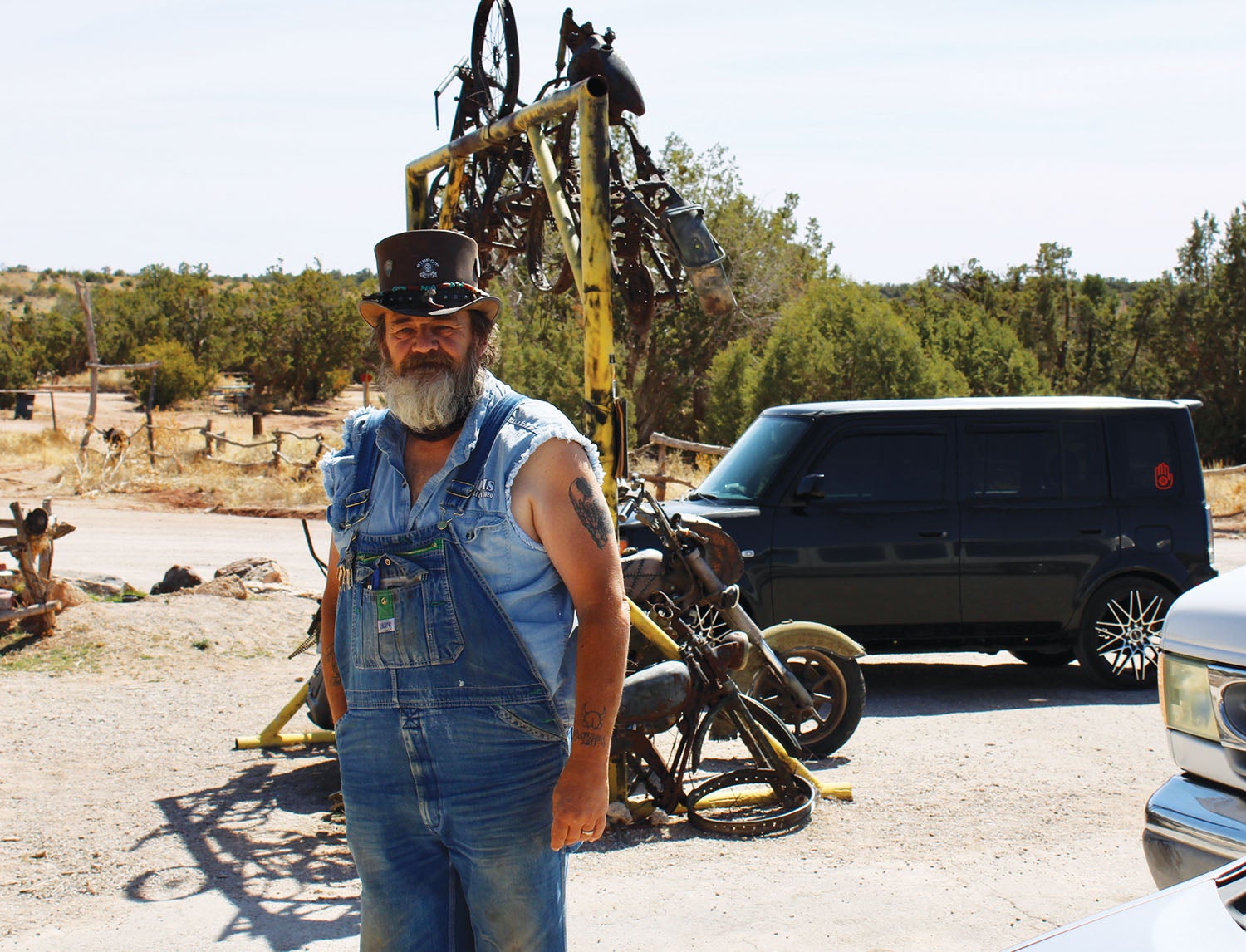
The next stop on this adventure is a step back in time, both millions of years ago and the post-war glory days of Route 66. We launched out west to Grand Canyon Caverns (L37). Caverns is an interesting place, full of old relics, fake dinosaurs and the like. The runway is on the nicer end of unimproved, and parking favors one way in one way out without having to back taxi. In past times, one could taxi right up to the main parking lot of the gas station and park among the cars and tour busses, but signs (perhaps temporarily) asked aircraft to park on a couple of dirt ramps near the runway. There is one abandoned hangar without a door available on a first-come basis. We were securing the aircraft when host Klaus pulled up in a van to carry us up to the main part of the complex.
Caverns is said to be the inspiration for Radiator Springs in the movie Cars. The place features a gas station, motel and cafe, not to mention tours via creaky old elevator down to the actual caverns, advertised as the largest “dry” caverns in the U.S. The place itself is well past its prime, but paradoxically, that grunge of neglect somehow adds to its charm. Most love it, some not so much.
The caverns themselves are well worth seeing, and the whole stop can be accomplished in an hour or two and make an interesting addition to the trip as a whole. The airstrip is also used on occasion as a launching point for trekking to Havasu Falls.
The Big Ranch
By now, it was mid-afternoon on day one, and we were ready to cross the Grand Canyon to Bar Ten Ranch (1Z1) on the north rim. (Incidentally, the facility calls itself Bar 10, but the FAA has it as Bar Ten on the charts.) The flight is short but spectacular. Aircraft with sufficient performance to get above the restricted airspace (meaning at 9000 feet msl or above) can pretty much fly direct. Others can venture out to the west and then turn and approach the airport as desired. There is a bubble carved out of the restricted airspace for operations to and from the airport. See the current charts for more information.
Bar Ten’s runway is plenty long at 4600 feet and steeply uphill to the north. The old school gouge was that the slope was worth 20 knots of tailwind, which seems about right. The runway surface is officially called “chip seal,” which falls somewhere between dirt and asphalt. All patterns are to the west for terrain. There is a shallow canyon to the northwest where the trail from St. George comes in that makes for a nice natural downwind entry. Arriving from the south, we eased out to the west before looping back to enter left downwind for Runway 34. The winds at altitude were howling out of the southwest, so a guinea pig (me) was sent in to check on conditions. The winds abated below 500 feet to just a light quartering tailwind on touchdown. Brakes were never needed until the parking ramp. The parking ramp is plenty large but is unpaved and requires both stakes and straps for security. Four or five aircraft were already parked. Commercial operators in Caravans and Twin Otters frequent the airport, and they appreciate some room left at the top of the parking ramp for them.
We hand maneuvered the airplanes around to a slightly downhill 45° angle to the runway to allow for an easier and more propeller-friendly departure in the morning. Once again we were securing the aircraft when the lodge van lumbered down to retrieve us.
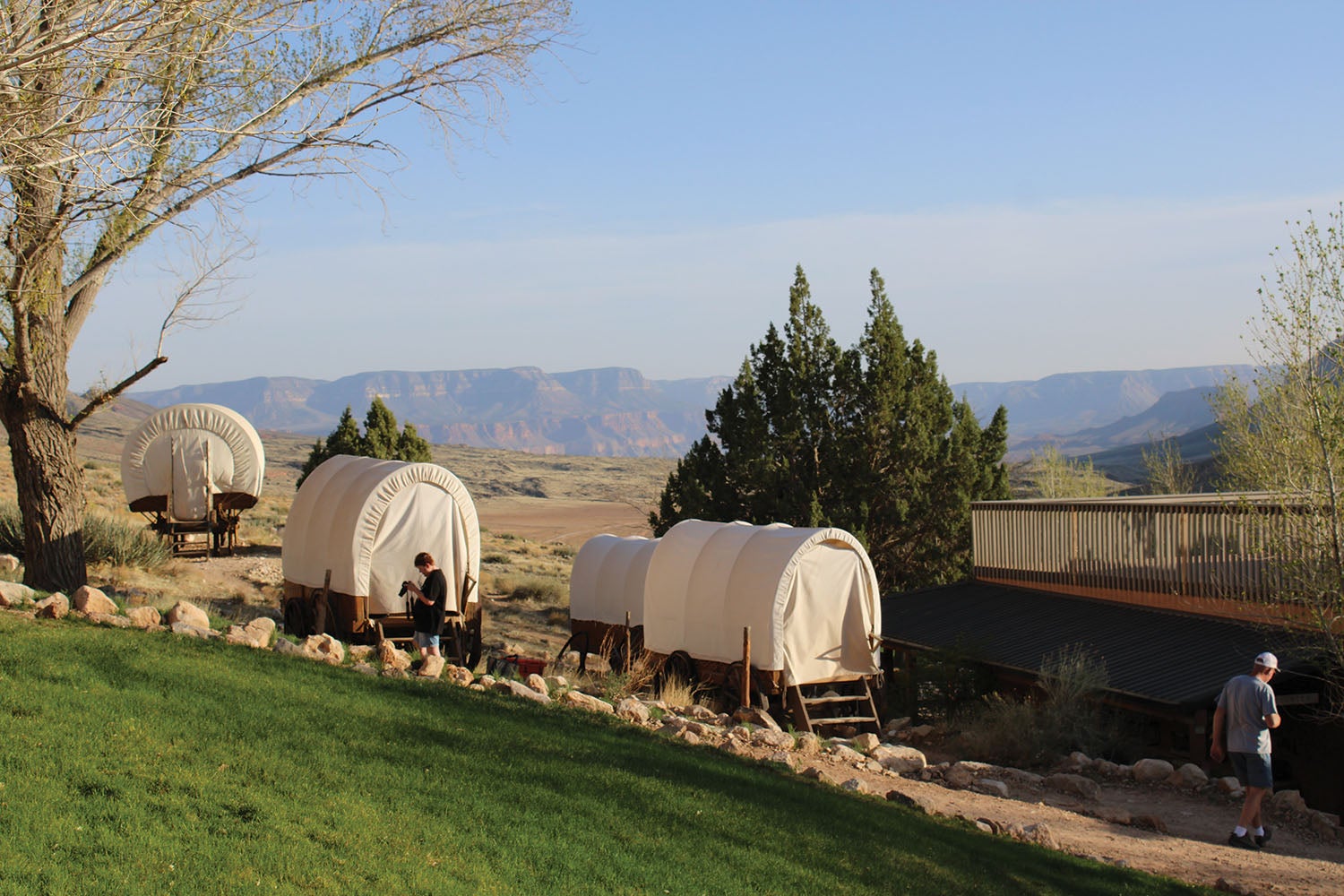
Bar 10 Ranch is a unique property. A working cattle ranch also became an ideal location for supporting the Colorado river running industry. A helipad was put in on the water’s edge just past the Lava Falls rapids, and enthusiasts who started at Lee’s Ferry would disembark while others would take their place for the shorter and much tamer ride down to Pearce Ferry on Lake Mead. They also feature rodeo grounds, skeet range and log stage where Branson-type outdoor shows are performed during peak season. During river season, it is one of the busiest unimproved airports in the country. Lodge accommodations include a dozen or so covered wagons dotting the hillside behind the lodge with little more than a bed, a battery-powered lamp and fresh air under bright stars.
As we anxiously awaited our chuckwagon dinner, a fellow walked up to our group and asked if we were the ones who had just flown in. He said they had watched our sporty arrival in the winds and added that they were debating whether we would make it in. Then it dawned on me that I knew this fellow from my airline days. He then pointed out three other retired airline guys and their companions in their group, and I knew them all. Here we were, in one of the most remote places in the lower 48—a three-hour drive to the nearest town—and you can’t swing a dead cat without hitting a smarmy former airline pilot. We were seven in all, six from Southwest and a token Delta guy. (We let the Delta guy cover the tips). We told a lot of stories that night, some inspired by actual events. Great times in wonderful places made better by the presence of old friends. Even better, every single pilot had a connection to Experimental aviation.
Day Two
After a chilly but refreshing April night in the covered wagons, we were fed a hearty breakfast and prepared for day two of the adventure. We departed to the south toward the canyon and then cut a one-eighty back to the north to Kanab, Utah, for fuel.
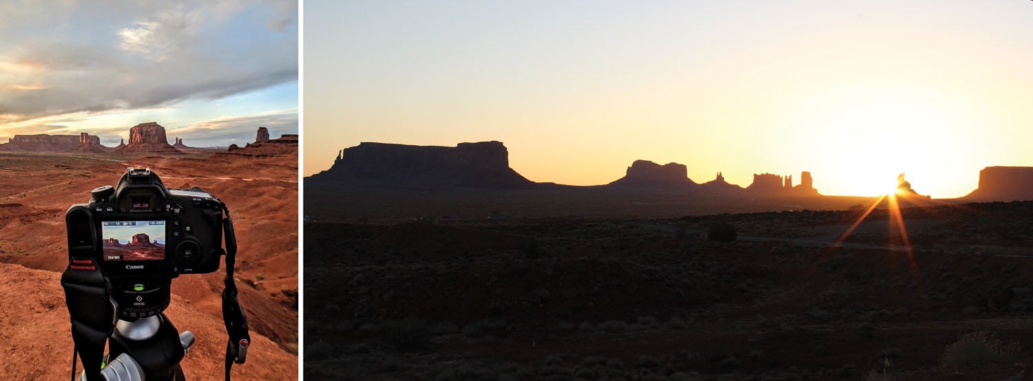
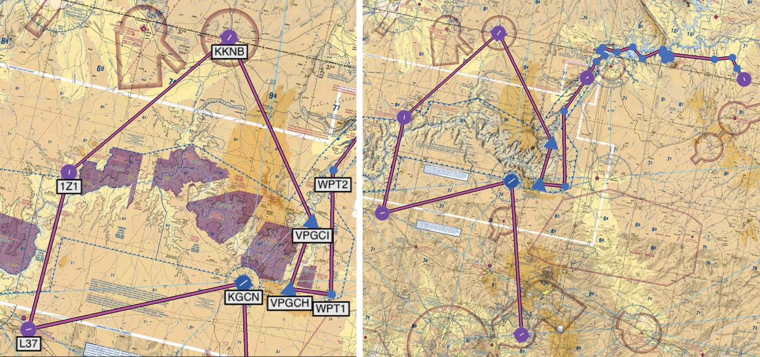
The next leg from Kanab to Monument Valley is really the whole reason for the trip. Most of the point-to-points so far have been fairly direct, but this leg will be a circuitous “scenic” route as we take a couple of hours to delight in what could be flown in less than half that time direct. We also slowed way down to about 100 knots to rest the ponies and soak up the view.
Being mindful of the various minimum altitude restrictions of the special rules airspace, we launched to the southeast to waypoint VPGCI then south through the Zuni Point corridor to VPGCH and then a lazy 180 to the left around the Desert View flight free zone back up north toward the confluence with the Little Colorado and then continuing toward Marble Canyon. This route gives a stunning view of the southeast elbow of the Grand Canyon with a wide variety of vistas.
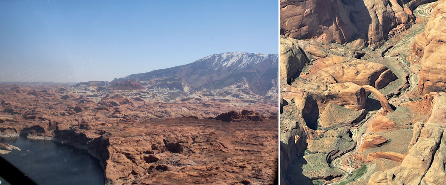
As we left Grand Canyon behind and progressed north toward Lake Powell, we flew the same basic tour route employed by commercial operators for decades. While the constant maneuvering would be impossible to describe accurately in this treatise, the highlights include Glen Canyon Dam, Wahweap Marina, Lone Rock, Gunsight, Cookie Jar, Gregory Butte, Cummins Mesa, then back over the main channel past Dangling Rope Marina. We then followed the channel to Forbidding Canyon. We turned south toward Navajo Mountain to make a right-hand climbing 360 around Rainbow Bridge, the largest natural stone arch ever discovered. Once we made the arch circuit, it was time to turn toward the east over some of the most rugged terrain on the planet toward the next visual treat of Monument Valley. Monument Valley, a part of the Navajo Nation, is one of the most photographed regions in the world.
Goulding’s airport (UT25) is part of a large campus of facilities on the Navajo Nation. Its single paved runway is one way in, one way out due to sharp cliffs at the south end. The upper paved parking ramp is for commercial operators only, but there is a large compacted dirt ramp and restroom facilities for visitors. Tie-downs are necessary but can attach to steel cables stretching the length of the parking ramp. Something new was a form required to be completed and forwarded prior to receiving permission to use the airport.
In addition to the airstrip, Goulding’s features a gas station, lodge, restaurant, restored trading post, movie museum and arts and crafts gift shop. The complex is a main hub of activity during peak tourist seasons, and tour buses and foreign languages abound.
Thus completes the longest and usually favorite leg of the aerial excursion. First-timers are agape that there is so much stunning and varied topography in such a relatively confined area as this leg. Old-timers never get sick of it. After the charming but admittedly Spartan conditions of the covered wagons of Bar 10 Ranch, it was nice to enjoy a proper hotel room for the night. Every room at the lodge has a patio with a beautiful view of the valley.
After a nice dinner, good night’s rest and a hearty breakfast, the tour is technically over, and parties are free to go their separate ways. There are numerous additional places to see in Color Country. On day three, we flew back toward Page, passing to the south side of Navajo Mountain for an additional perspective of some of the 186 canyons of Lake Powell before turning south for home.
I don’t write this to drum up guide business because I have no guide business to promote. I write this as a helpful catalyst for folks to put together their own Color Country adventure.
If you stick to the flyovers, this trip can easily be accomplished in a day. But it’s the stops and layovers that make the adventure and camaraderie special. Therefore, someone planning a trip like this needs to start early as the recommended overnight accommodations often need to be booked months in advance to align up consecutively. Bar 10 is particularly hard because they are seasonal and fully booked with river business outside of just a few weeks before and after the river season.
As I close, I am reminded of a special moment in the Grand Canyon: The Hidden Secrets IMAX movie. The uncredited narrator says something that, even after dozens of viewings, still causes my scalp to tingle and gives me a deep feeling of gratitude for my aeronautical passion. Under a mesmerizing backdrop of a solitary ultralight aircraft silently exploring the canyon, he says: “It is only on the tiny trailing edge of time that man has been able to share the magnificent perspective of the birds…our ability to fly has forever changed our relationship…[to our world].”
Flying a trip like this is extremely rewarding. Doing so in your own personally constructed aircraft after years of labor and effort is even more special and satisfying.
For more information:


Thanks for the great article Myron! I feel very fortunate to have gone on this trip with you. Your knowledge of all the landmarks here made it a real once in a lifetime flying trip. Let’s do it again sometime!
Myron, any chance you could share your trip on ForeFlight? It looks amazing. Thanks
Comments are closed.